SPATIAL DATA - DIGITAL PRODUCTS
Information System for Multi-Level Documentation of Religious Sites & Historic Complexes, Acronym: 5dMeteora
Products Production:
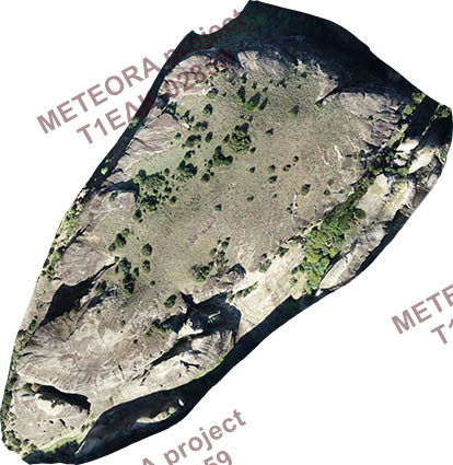
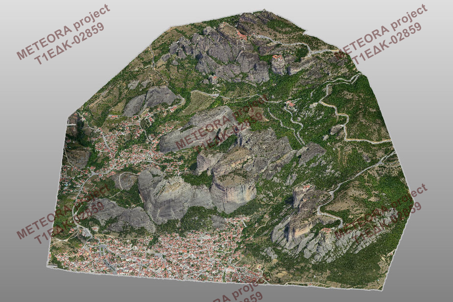
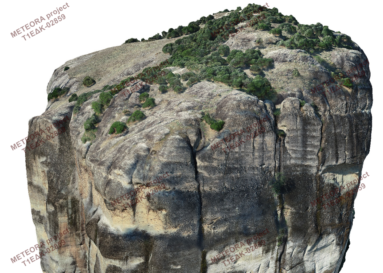
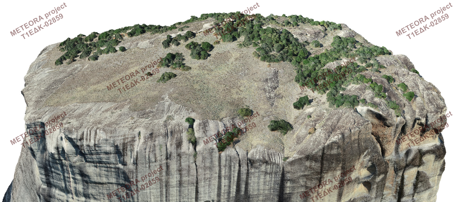
The products of data collection and data processing that constitute the input data of the platform are the 3D models of the Archaeological Site of Meteora and the two rocks, Modi and Alyssos, as well as the orthoimages of part of the Archaeological Site of Meteora and the dense point clouds of the two rocks. The last two types of metric data are only available to certain categories of users, namely the geospatial engineers, architects and archaeologists, while the point clouds are only available if requested, upon approval by the system administrator, subject to the terms of a relevant license. The 3D surface model of the Archaeological Site of Meteora with texture generated using the oriented images is shown at figure 1.
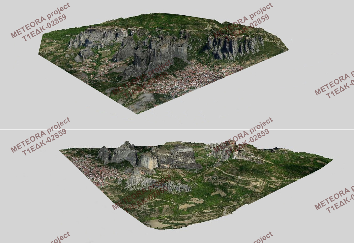
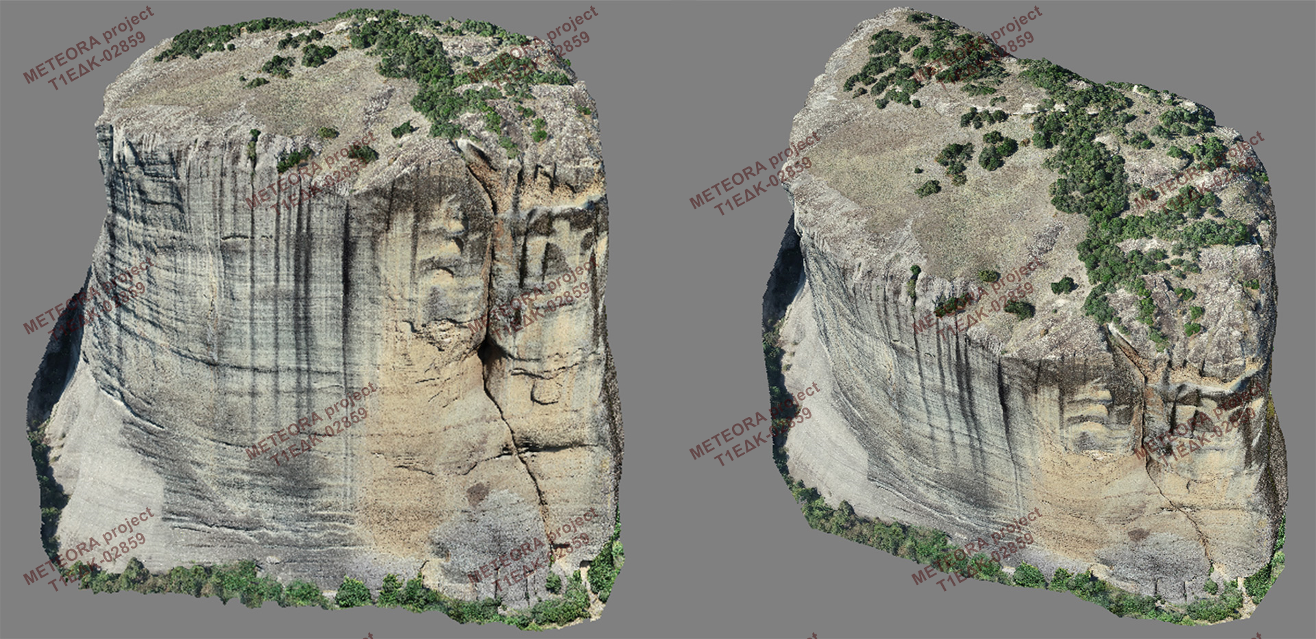
The dense point cloud consists of 353,140,592 points, while the surface includes 67,471,539 faces and 34,029,510 vertices. The 3D model of OBJ format of the rock of Modi has a size of about 650 MB and consists of 34M triangles while the 3D model of the rock of Alyssos has a size of 400 MB and 27M triangles (figure 2-5).
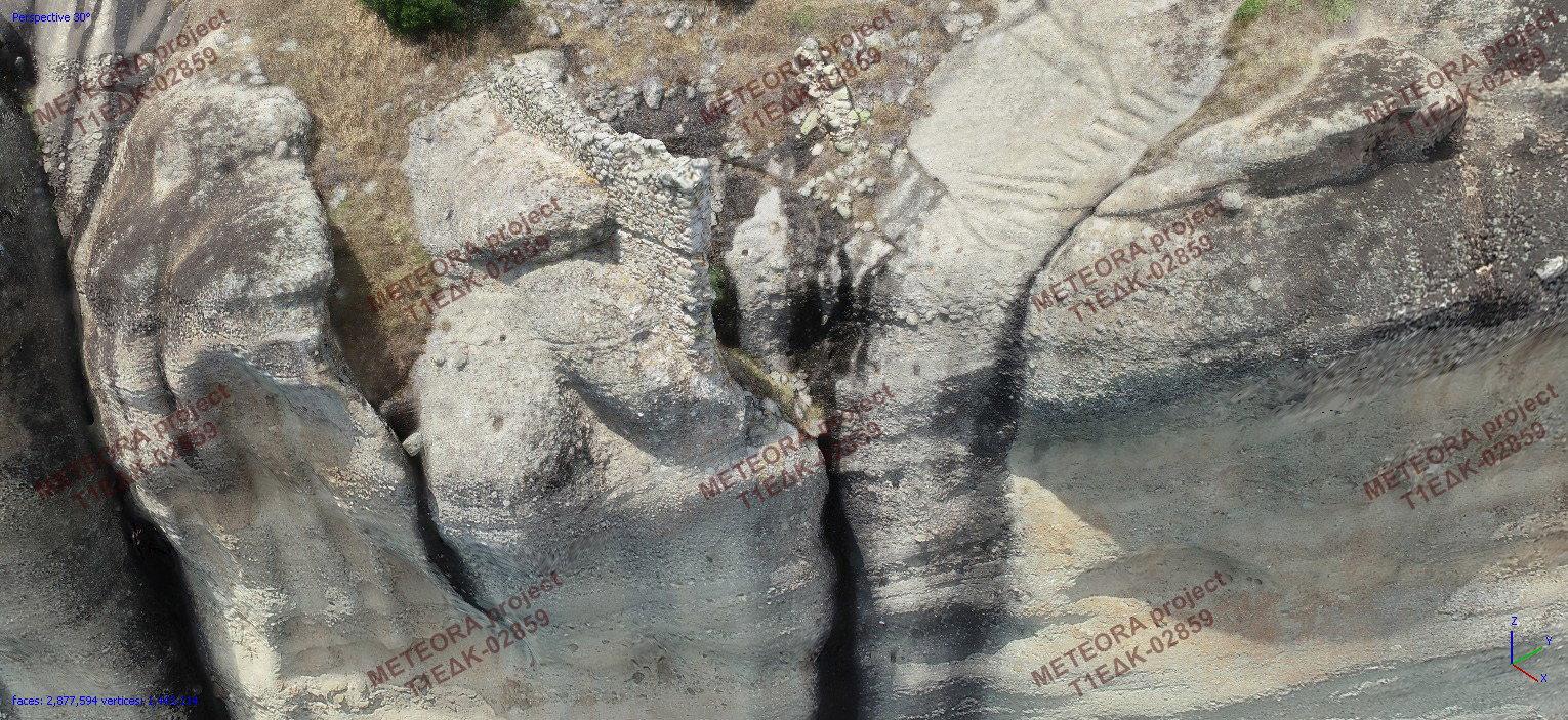
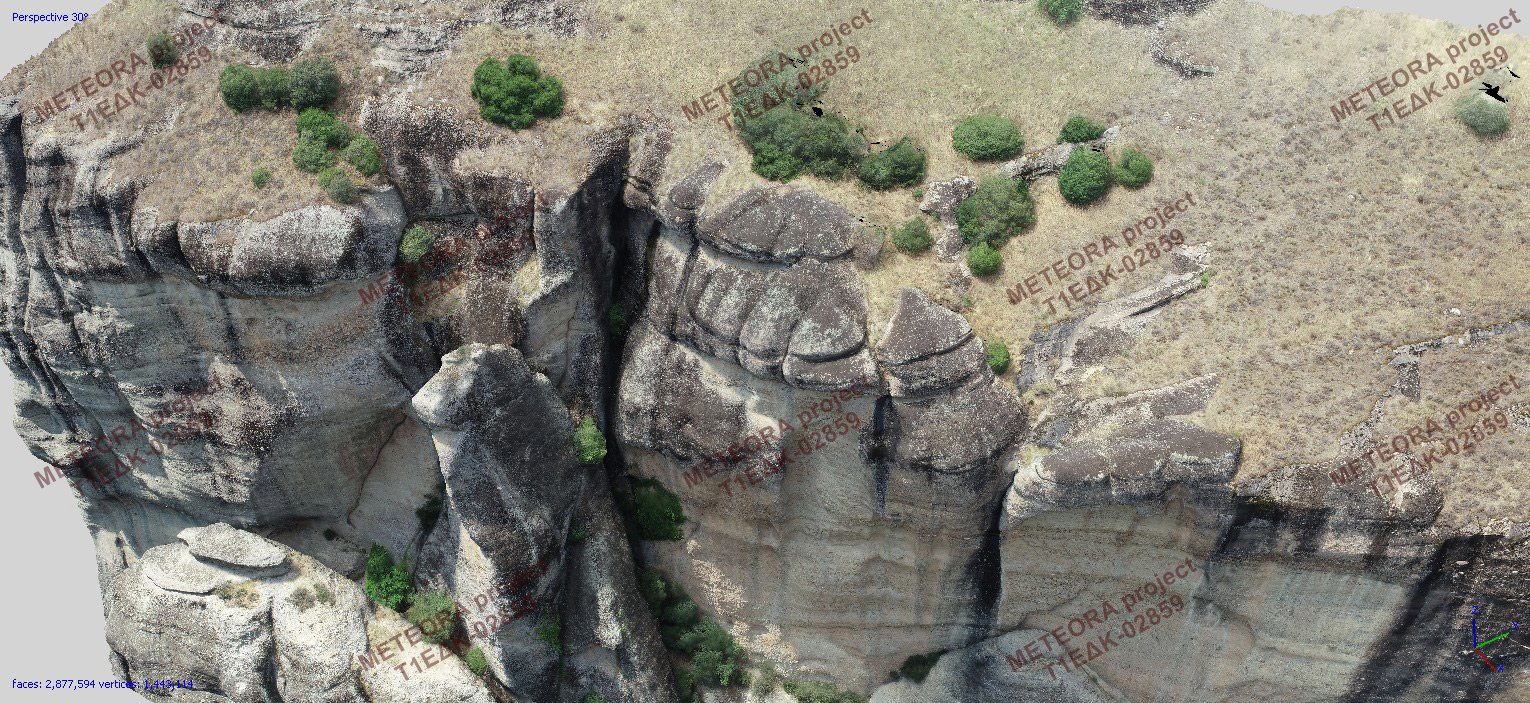
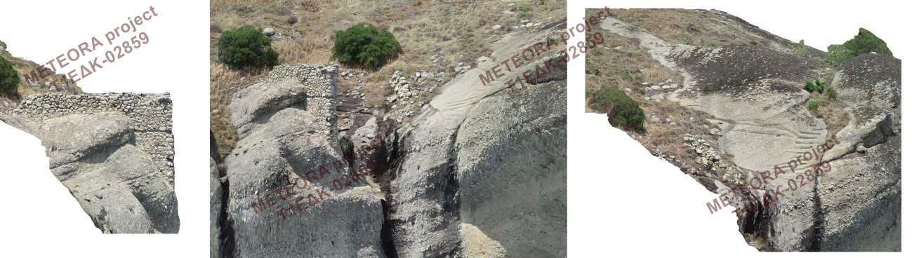
Moreover, the following products were created: (i) Digital Elevation Model (DEM) of the Holy Site and the wider region of Meteora, as well as, (ii) Orthoimages and orthomosaics of the wider region of Meteora and of various sections of the two rocks for architectural documentation. Projections were made manually at selected points of interest, mainly on the west side of the rock of Modi and on the facades of the old Tower for architectural and archaeological surveying of remains visible over ground of buildings and other structures (Figure 6, Figure 7). The orthoimages of the rock of Modi were used for the interpretation of the current state and as a metric background for the 3D reconstruction of the old Katholikon (church) that no longer exists.